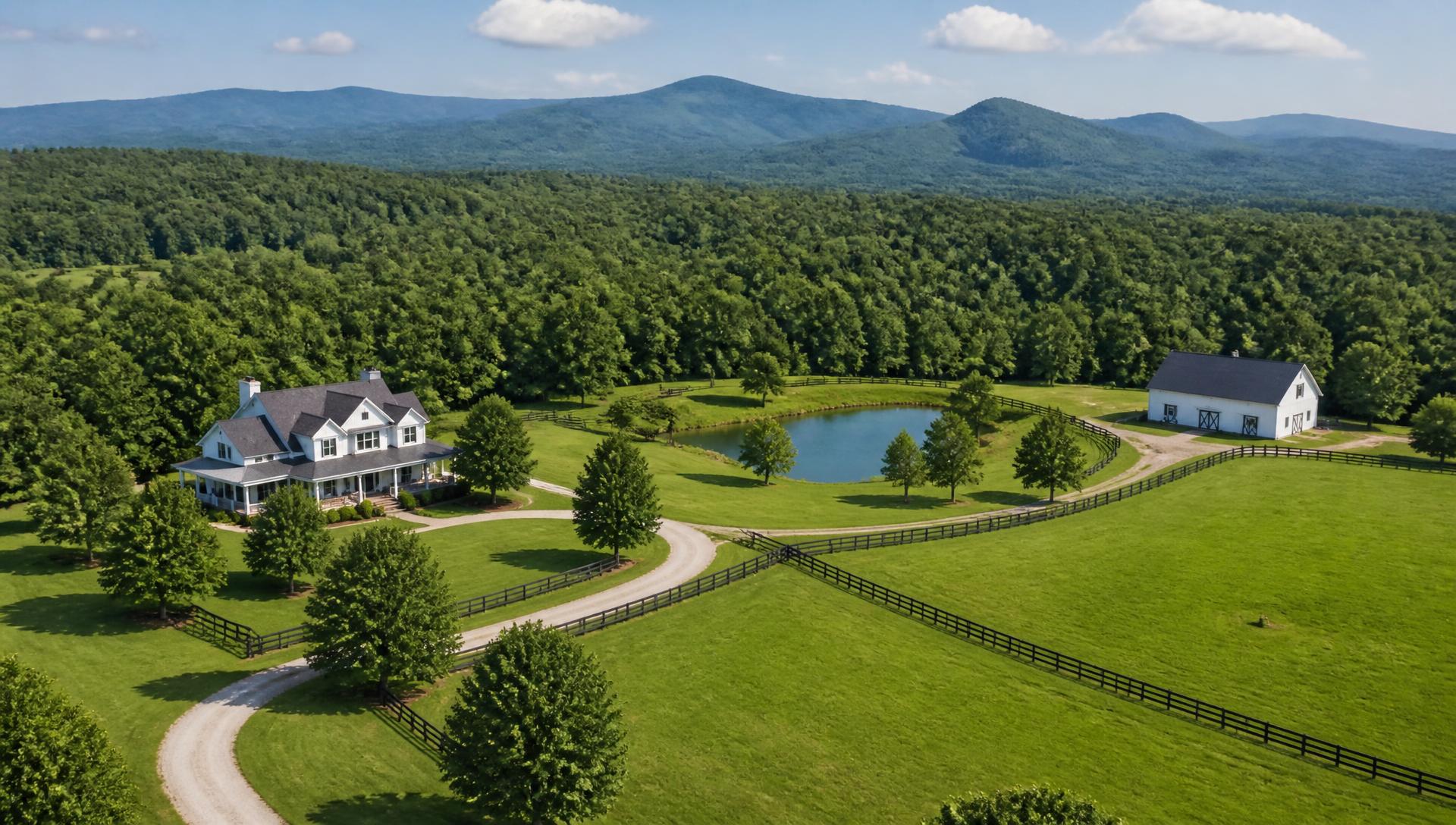
Blairsville, Georgia land development and estate property work — Aerial view of a North Georgia estate with pastures, barn and tree-lined drive

Union County Acreage

Land Development in Blairsville, Georgia

We build and improve land in the high valleys around Blairsville, where cattle farms, weekend retreats and Nottely Lake homesites all answer to the same mountain terrain.

Start your property project

Union

Building on Union County's High Ground

Blairsville sits in a broad mountain valley near 1,900 feet, ringed by the Blue Ridge, Brasstown, and Track Rock ranges. That elevation gives owners cooler summers and long views, but it also means most tracts here are a patchwork of flat bottomland along the Nottely River and steep hillside pasture that needs real engineering before it will hold a driveway or a barn.

Nottely Lake and the smaller coves off Lake Chatuge draw buyers who want lakefront without Metro Atlanta traffic. Those parcels come with TVA shoreline management rules on top of Union County's own grading permits, and we coordinate both before equipment ever moves dirt.

Cattle operations and hay farms are still the backbone of the valley floor, so we spend as much time on fencing, pond access, and farm road base as we do on residential driveways. Rock is common once you climb off the bottomland, and we scope excavation with test digs, not guesswork.

What makes this market different

TVA Shoreline Rules at Nottely Lake

Any grading, dock, or vegetation work near the Nottely Lake shoreline falls under TVA's Shoreline Management Initiative. We handle the permit application alongside county requirements so lakefront clearing and access roads stay compliant.

Rock Close to the Surface

Hillside lots above the valley floor often hit granite and schist within a few feet of grade. We test-dig before quoting driveways or foundations so owners aren't surprised by blasting or rock-hammer costs mid-project.

Union County Land Disturbance Permits

Union County requires a land disturbance permit for grading beyond a small threshold, with erosion control plans reviewed before work starts. We prepare the plan set and manage inspections through final stabilization.

Cattle Fencing on Sloped Pasture

Perimeter and cross-fencing on the valley's rolling pasture has to account for washouts at low crossings and gate placement that keeps herds off saturated ground. We design fence lines around the land's drainage, not just the property lines.

Featured services

What we build in Blairsville

Valley and Hillside Site Development

We clear, grade, and prep building sites across the mix of Nottely River bottomland and steep valley-wall pasture that defines Blairsville. Every plan starts with a topo and a soils read, since the right pad location can save an owner tens of thousands in retaining wall and cut costs.

Land Development

Managing Runoff Above the Nottely Watershed

Water moves fast off Union County's steep slopes toward the Nottely River and its tributary creeks. We install swales, culverts, and rock-lined channels sized for mountain storm intensity, keeping silt out of the river and off neighboring pasture.

Drainage & Erosion

Horse and Cattle Farm Infrastructure

From loafing sheds to cross-fenced rotational pasture, we build farm infrastructure suited to Union County's grazing operations. Barn pads get leveled and drained properly so mud season doesn't shut down access to stalls or hay storage.

Equestrian

Perimeter Fencing for Rolling Pasture

We run high-tensile and board fencing across contour rather than straight lines wherever the terrain demands it, with reinforced corners on grade changes. Gate approaches are graded and stoned so they don't turn to mud with fall rain.

Fencing & Entries

Barns and Equipment Sheds on Valley Land

We build pads and foundations for barns and equipment storage sized to real farm use, from square footage to the turning radius for hay trucks. Site drainage around the structure gets solved before the slab goes in, not after.

Barns & Outbuildings

Retaining Walls for Steep Approach Roads

Many Blairsville homesites need a wall system just to get a level driveway or house pad off a hillside. We engineer segmental and boulder walls rated for the loads and slope angles common in the Blue Ridge foothills.

Retaining Walls

Gravel and Paved Access on Mountain Grades

Long, steep driveways are the norm here, and they fail without proper base depth and cross-drainage. We build access roads with compacted aggregate base and culverts placed at every natural drainage crossing.

Driveways & Access

Outdoor Living with Mountain Views

Patios and fire pit areas here are sited for the long valley and ridge views Blairsville is known for. We grade and drain these spaces so they hold up through freeze-thaw cycles at elevation.

Outdoor Living

Whole-Property Planning for Farm and Retreat Land

We map out how a working farm, a lake cove, and a mountain retreat can share one property plan, sequencing site work so pastures, driveways, and homesites all drain correctly together.

Property Planning

Property types

Properties we work on around Blairsville

Nottely Lake Cove Homesites

Lakefront and near-lake parcels with TVA shoreline rules layered on top of county grading requirements.

Cattle and Hay Farms

Valley-floor operations needing fencing, pond access, and farm road maintenance on rolling ground.

Mountain Retreat Tracts

Wooded hillside parcels bought for privacy and views, typically requiring rock excavation for driveways.

Small Acreage Horse Properties

5 to 20 acre parcels combining a home site with pasture, run-in sheds, and cross-fencing.

Why owners choose us

One team, one plan, from first walk to final walkthrough

01

Property consultation

We walk the land with you, read the topography and water, and separate what the site needs from what it would merely be nice to have.

02

Planning

Access, drainage, building envelopes and structures get planned together, with a phasing order that protects the budget.

03

Design

Drawn plans for grading, walls, fencing, barns and landscape so every trade builds from the same document.

04

Construction

One crew and one point of contact, working the plan in the sequence that keeps finished work from being torn back out.

05

Final walkthrough

We walk the property after the first heavy rain, confirm everything drains and functions, and hand over a maintenance plan.

Featured work

Deep dives for Blairsville property owners

Questions

Blairsville property questions

Answers specific to this market. If yours isn't here, call 678-578-8114.

Do I need a TVA permit if my land touches Nottely Lake?

If you plan to grade, clear vegetation, or build a dock within TVA's shoreline management boundary, yes. This is separate from Union County's land disturbance permit, and both need to be in place before work starts. We handle the applications for clients as part of site planning.

How much rock should I expect on a Blairsville hillside lot?

It varies block by block. Bottomland near the Nottely River is usually workable soil, but hillside lots above it often hit granite or schist within a few feet of surface. We recommend a test dig before finalizing a driveway or foundation budget.

What triggers a Union County land disturbance permit?

Grading beyond the county's disturbance threshold, work near streams, or any project affecting more than a set acreage requires a permit and an erosion control plan. Most driveway and homesite projects on raw acreage will need one; we prepare the plan and manage inspections.

Can you fence pasture that includes steep grade changes?

Yes. We route fence lines along natural contour where possible and reinforce corner and gate posts on slope transitions, since those points take the most stress from soil movement and runoff.

How long does driveway construction take on a mountain lot?

A typical 500-800 foot gravel driveway with culverts takes one to two weeks depending on rock encountered and weather. Steep or long approaches with multiple drainage crossings can run three to four weeks.

Do you work on properties near Track Rock Gap or the Brasstown range?

Yes, we serve all of Union County including the more remote tracts near Track Rock Gap and the Brasstown Bald foothills. Access and utility distance are the main planning factors on those sites.

Is spring water a concern for building sites here?

It can be. Many hillside lots have seasonal springs or seep zones that aren't obvious in dry months. We walk the property after rain when possible and design drainage to intercept groundwater before it reaches a foundation or driveway base.

What does it cost to build a farm road versus a residential driveway?

Farm roads generally use a lighter base spec since they carry less frequent, lower-speed traffic, while residential driveways need a deeper compacted base to handle daily vehicle loads. Costs depend on length, rock, and drainage crossings rather than a flat rate.

Do you handle erosion control near the Nottely River itself?

Yes. Any work within the river's buffer zone requires extra care and often a stream buffer variance. We design silt fencing, matting, and vegetative buffers to keep the river clean during and after construction.

Can you build a barn pad on a sloped pasture?

Yes. We cut and fill to create a level pad, then grade around it so surface water sheds away from the structure instead of pooling at the foundation, which is the most common failure point for barns built without proper site prep.

Start here

Start your property project

Tell us about your Blairsville property. We'll come back with what the site needs, what order to do it in, and what it's likely to cost.

What are you planning?

No obligation. We'll respond within one business day.